One plan decides, and its replacement is published.
The Warwick District Local Plan 2011 to 2029 decides every application in both towns. The joint plan that replaces its strategic policies reached publication stage in July 2026.
Read moreConservation areas, Green Belt edges and back-land plots. One council decides them all.
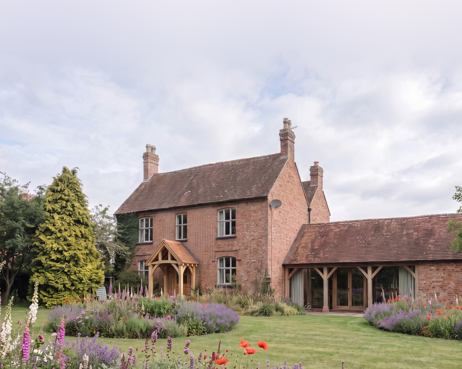
A farmhouse and its redundant barn, consented as one home.
View project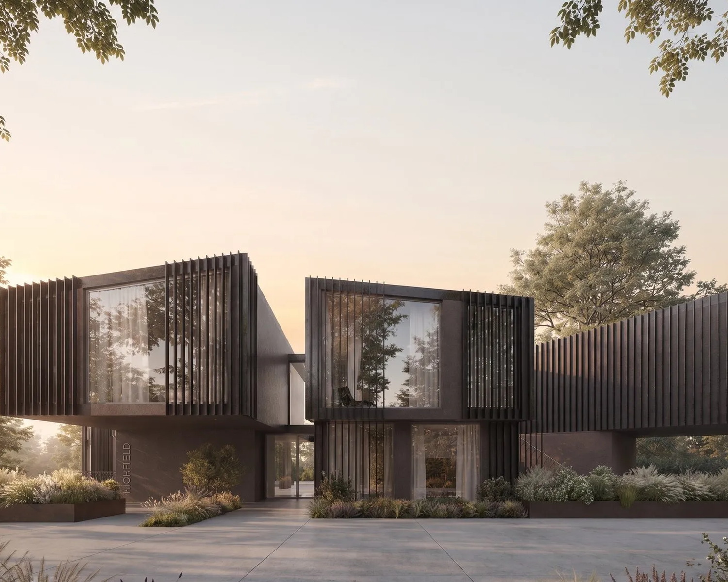
Seven apartments consented on a plot pinched by two protected trees.
View project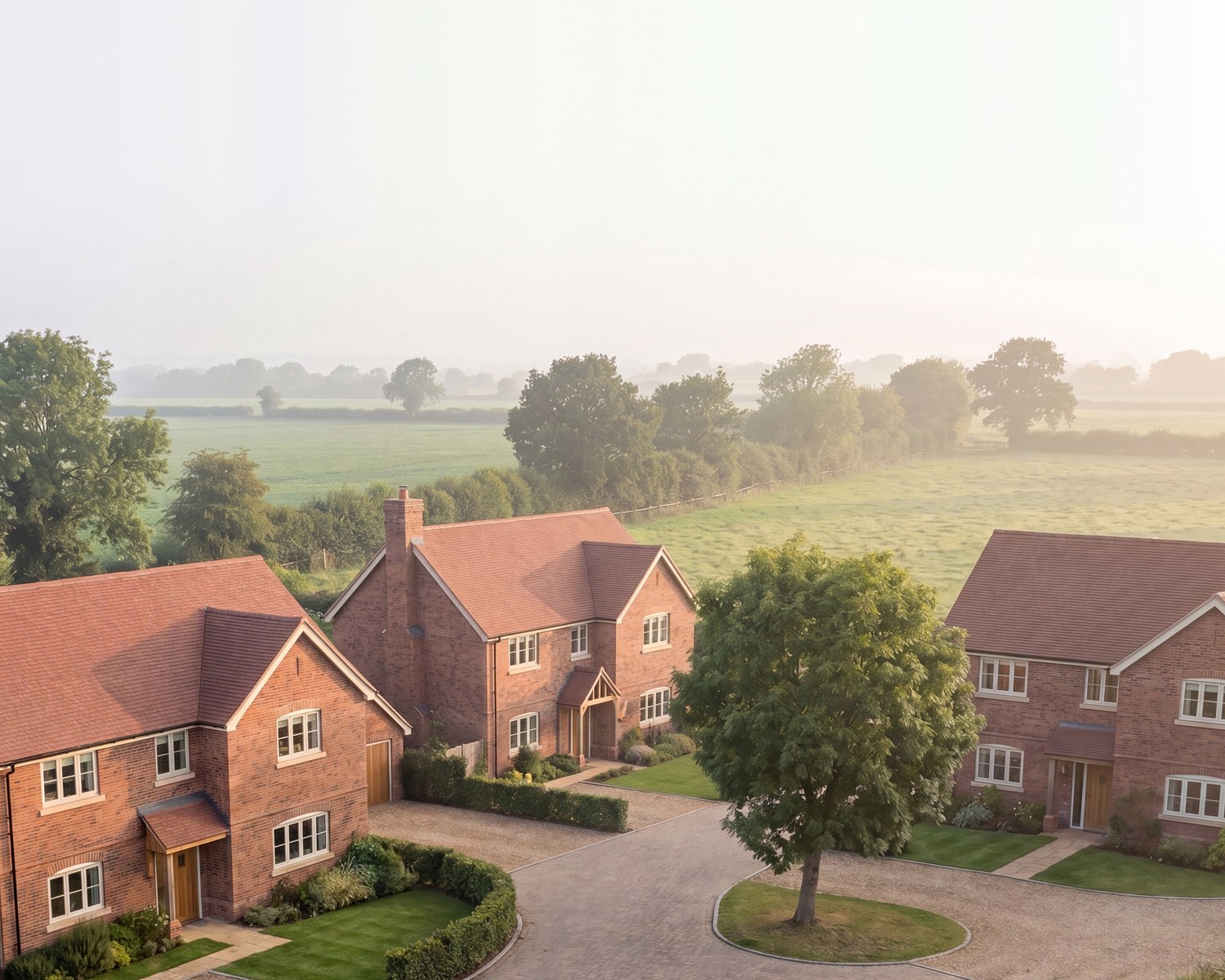
One bungalow replaced by four homes, granted at committee.
View project
An orangery on a listed house, consented once an objection was withdrawn.
View projectWarwick and Kenilworth are one council and one adopted plan. The joint plan that will replace its strategic policies went to its final consultation in 2026. Six things shape most schemes in both towns.
The Warwick District Local Plan 2011 to 2029 decides every application in both towns. The joint plan that replaces its strategic policies reached publication stage in July 2026.
Read moreThe council's own paper puts the district at 1.96 years of deliverable housing land supply, against the five years national policy asks for.
Read morePolicy H2 applies at eleven dwellings or at 1,000 square metres of floorspace, whichever comes first. The second limb catches smaller schemes.
Read moreWarwick and Kenilworth each have their own conservation area and appraisal, and Policy HE2 presumes in favour of keeping the unlisted buildings that earn their place.
Read morePolicy DS18 is two sentences long and hands the whole question to the national framework. Kenilworth and the villages west of it border the Green Belt.
Read moreWarwick is in the district's lowest residential CIL zone and Kenilworth in one twice the rate, five miles apart.
Read moreWarwick District Council policy, correct at August 2026. The South Warwickshire Local Plan is at publication stage and the housing land position is restated every year, so we re-check them at the point of application.
Sixteen years of consents on this ground, from a replacement garage to seven apartments beside the Kenilworth Conservation Area, and a back-land plot won at committee in October 2025.
See the work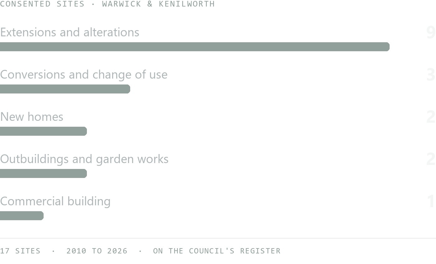
Every application we make is a matter of public record on a council planning register. Ours reach more than 100 planning authorities across the UK, and Warwick District has been receiving applications in our name since 2002. The practice has been working since 1970.
Developers, homeowners and commercial clients all need the same first answer: what will this site take? The route to it changes with the project.
Back-land plots, village sites and small apartment schemes, from residential architects who design schemes that are viable and buildable, with the planning case built in from the first sketch.
Residential developmentExtensions, remodels and barn conversions, including the conservation area rules that decide what a Warwick or Kenilworth house is allowed to become, designed around how you live.
Private homesShops, offices, community buildings and change of use, from commercial architects who argue the case with the evidence Warwick District expects to see.
Commercial workFour homes consented at committee on a back-land plot at Burton Green. Seven apartments consented on a pinched plot beside the Kenilworth Conservation Area. Yours would not be our first Warwick District conservation area, or our first protected tree.

Straight to a complete, valid submission. The delays that cost a programme are the avoidable ones, not the statutory clock.
A lead architect is involved from the first conversation to the last drawing. The team that starts your scheme stays with it, so nothing is passed down a chain.
Appraised properly, in the open, by someone who knows what a council needs to see and when the right answer is to push back.
 Green Belt Conservation area
The land left in these two towns sits behind existing frontages or up against the Green Belt, so access, trees and the neighbours decide the layout long before elevations do. Four homes at Hob Lane were consented on exactly that ground.
 shared access protected trees committee Green Belt
Costs staged behind certainty. Every commitment waits for the decision that justifies it, so nothing is spent on a scheme that has not earned it.
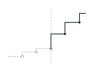 appraisal consent your spend
From first appraisal to final discharge, every survey, report and condition is tracked for you. You are not the one chasing an ecologist in week nine.
 Ecology surveyReport inCondition 7tracked to discharge
Tell us about it and a Senior Architect will give you an initial appraisal and guide you as to what to do next.
Start a conversationYes. Norton Lindsey, Kenilworth and Burton Green are all places the practice has worked, from a farmhouse and its redundant barn consented as one home to four new houses won at planning committee in October 2025. Applications in our name have been going to Warwick District Council since 2002, and they sit on the registers of more than 100 planning authorities across the UK.
No, and it is a long way short. The council's own paper put the district at 1.96 years of deliverable supply at 1 April 2025, against a five year requirement of 5,696 dwellings and an identified supply of 2,230. Under the August 2026 national framework, a shortfall on that scale opens up well-related housing sites on the edge of a settlement outside the Green Belt. Housing inside a settlement starts from a presumption in its favour whatever the supply. It is a presumption, not a waiver: heritage, highway safety and efficient use of land still decide applications here.
Forty per cent, and the trigger has two limbs. Policy H2 says residential development on sites of 11 or more dwellings, or where the combined gross floor space is more than 1,000 square metres, will not be permitted unless 40 per cent affordable housing is provided. The floorspace limb catches schemes with fewer than eleven homes, so a small number of large apartments can cross the line. Amount, form, location and delivery are negotiated at application, and viability is a legitimate part of that negotiation.
It roughly doubles between the two towns. On the schedule that took effect on 1 January 2026 the residential rate is £92.41 per square metre in Zone A, which covers Warwick, and £184.82 in Zone C, which is Kenilworth. The towns are five miles apart, so a scheme moved across that boundary carries a materially different levy. Rates are indexed each year to the RICS tender price index and the rate that applies is the one in force when the application is determined, so check the live schedule before a price is agreed on a site.
Sometimes, and the local plan adds almost nothing to the national test. Policy DS18 is two sentences: the extent of the Green Belt is defined on the Policies Map, and the council will apply national planning policy to proposals within it. So a Green Belt case here is won or lost on the national framework, on whether the development is inappropriate and, if it is, whether very special circumstances outweigh the harm. Other policies expand the exceptions, including limited village infill in the Green Belt and extensions to dwellings in the open countryside.
The starting position stops being the national permitted development rights. Both towns have their own conservation area with a published appraisal, and Policy HE2 sets a presumption in favour of retaining unlisted buildings that make a positive contribution. Consent to demolish one is only granted where the replacement design can show it will preserve or enhance the area. Article 4 directions are made area by area rather than district-wide, so check the designation, any listing and any direction before a design is fixed.
It is one of the harder cases and it is regularly won. A back-land scheme has to answer access, parking, drainage, trees and the effect on the neighbours who surround it, and objection is close to guaranteed, which often takes the decision to committee rather than an officer. At Hob Lane in Burton Green a bungalow and its grounds were consented as four detached family homes, with the parish council objecting and the officer recommendation upheld at committee in October 2025.
The Warwick District Local Plan 2011 to 2029, adopted in September 2017, is the statutory basis on which every application in Warwick and Kenilworth is determined.
Stratford-on-Avon and Warwick District Councils are preparing a joint South Warwickshire Local Plan running to 2050 to replace its strategic policies. That plan reached Regulation 19 publication stage on 21 July 2026. Representations closed on 8 September 2026 and the councils' timetable set submission to the Secretary of State by 31 December 2026. The stage matters commercially: an emerging plan gains weight as it advances, and publication stage is the last one before examination. Design to the adopted plan, and check where the emerging one has actually reached at the point of application rather than months before it.
Warwick District Local Plan 2011 to 2029 · South Warwickshire Local Plan, Regulation 19The council's five year housing land supply paper put the district at 1.96 years of deliverable supply at 1 April 2025, against a five year requirement of 5,696 dwellings and an identified supply of 2,230.
National policy asks every authority to hold at least five years. Under the national framework published in August 2026, housing inside a settlement should be approved unless the benefits are substantially outweighed by the harm, whatever the supply. A shortfall on this scale also opens up housing on the edge of a settlement outside the Green Belt, where it is well related and the infrastructure can take it. It is a presumption, not a waiver. Decisions here still depend on heritage, highway safety, the Green Belt and whether a site is being used efficiently, so the shortfall works best as one argument inside a scheme that is already close to policy, never as the whole case.
Warwick District Council · 5 Year Housing Land Supply Paper 2025Policy H2 is direct. Residential development on sites of 11 or more dwellings, or where the combined gross floor space is more than 1,000 square metres, will not be permitted unless provision is made for 40 per cent affordable housing. Amount, form of provision, location on the site and means of delivery are all negotiated at the time of the application, and viability is a legitimate part of that negotiation.
The floorspace limb is the one that surprises people. It is not a unit count, so a scheme of six or eight generous apartments can cross 1,000 square metres and trigger the full 40 per cent while a scheme of ten small houses does not. Testing the floor area against both limbs before the layout is fixed is what stops a scheme being redesigned twice.
Policy H2 · affordable housingWarwick and Kenilworth each have their own conservation area with a published appraisal, alongside Leamington Spa and Whitnash. Policy HE2 sets a presumption in favour of the retention of unlisted buildings that make a positive contribution to the character and appearance of a conservation area, and it says consent for total demolition of an unlisted building will only be granted where the detailed design of the replacement can demonstrate that it will preserve or enhance the area. Demolition is therefore argued through the replacement design.
Article 4 directions are made area by area here rather than across the district, so permitted development rights cannot be read off the national position. The council runs a property search that answers conservation area status, listing and whether a direction applies, by postcode. On a period building that check is the first thing worth doing, before a design is fixed.
Policies HE2 and HE3 · Warwick and Kenilworth Conservation AreasThe Green Belt covers a large part of Warwick District, including the ground around Kenilworth and the villages towards Coventry such as Burton Green. Policy DS18 is unusually short: the extent of the Green Belt is defined on the Policies Map, and the council will apply national planning policy to proposals within it. There is no additional local layer to satisfy, so a Green Belt case is won or lost on the national tests, on whether the development is inappropriate and, if it is, whether very special circumstances clearly outweigh the harm.
Other policies in the same plan expand the national exceptions, including limited village infill housing in the Green Belt, replacement dwellings and extensions to dwellings in the open countryside. Boundaries are not fixed for ever either: this plan removed several sites at Kenilworth from the Green Belt, including land at Thickthorn, Crewe Lane and Rouncil Lane. Where a village site sits relative to its village envelope on the Policies Map is usually the first thing to establish.
Policy DS18 · policies H11, H13 and H14Warwick District charges Community Infrastructure Levy by the square metre of new floorspace, by zone, alongside any Section 106 obligations. On the schedule that took effect on 1 January 2026 the residential rate is £92.41 a square metre in Zone A, which covers Warwick and the east of Leamington, and £184.82 in Zone C, which is Kenilworth. Zones B and D, covering much of Leamington and Whitnash, are higher again at £257.43.
Two things follow for anyone working across both towns. The same scheme carries roughly double the levy in Kenilworth that it does in Warwick, which is a real line in an appraisal. And the schedule is indexed each year to the RICS tender price index, so the rate that applies is the one in force when the application is determined, not when the land was bought. Check the live schedule before a price is agreed on a site.
Warwick District CIL charging schedule, effective 1 January 2026






Tell us about your project
A Senior Architect will reply. We will give you an initial appraisal and guide you as to what to do next.